Are you in search of breathtaking landscapes and unforgettable adventures? The Cote-Nord awaits you with its stunning panoramas and natural treasures to discover. Get ready to be amazed by the majesty of the fjords, the grandeur of the mountains, and the purity of the waters that characterize this unique region. Whether you're a hiking enthusiast, a photography lover, or simply a traveler in search of beauty, the North Shore will charm you with its breathtaking landscapes.
From Tadoussac to Kegaska, passing through Fermont, here are the must-visit stops along your way! These places are accessible by road and are mostly free of charge!

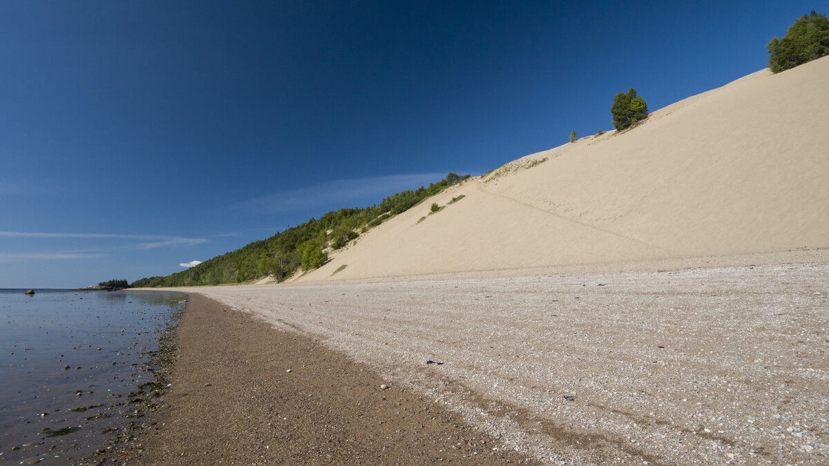
Landscape #1
The Dunes of Tadoussac
Located 5 km from the village of Tadoussac, the Dunes consist of two vast sand terraces, revealed by the last glacial melt approximately 10,000 years ago. Overlooking Baude Mill Bay, the Dunes site offers an exceptional panorama to admire the St. Lawrence River. Take the time to observe seabirds, raptors, and marine mammals that may pass through the maritime region.
♦
·
·
·
·
·
·
·
·
·
·
5,6 KM
·
·
·
·
·
·
·
·
·
·
·
·
·
·
·
·
·
♦
·
·
·
·
·
·
·
·
·
·
87 KM
·
·
·
·
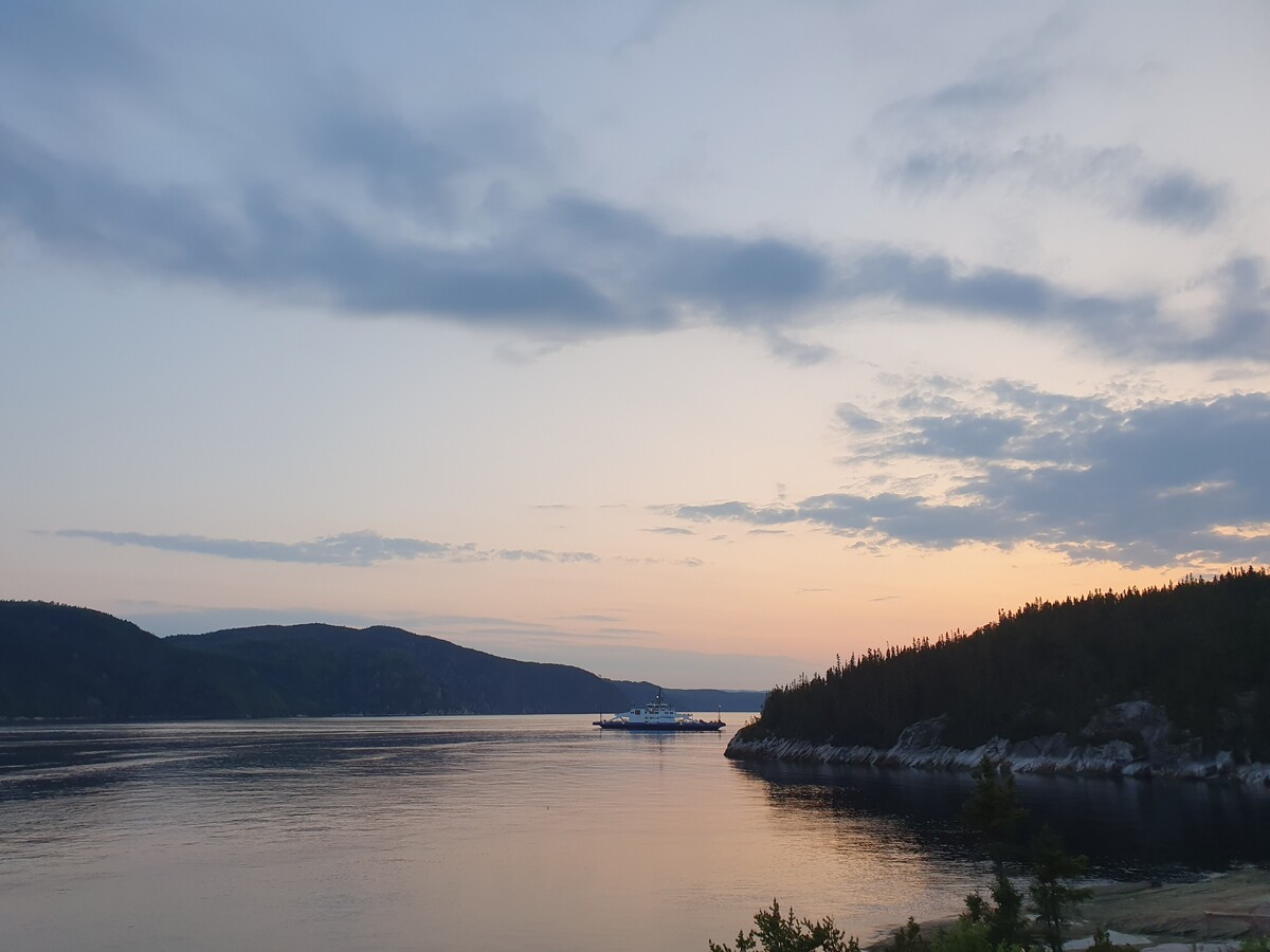

Landscape #2
Pointe-de-L'islet Trail
As you exit the ferry in Tadoussac, take a moment to discover Pointe-de-L'islet. This place is ideal for a pleasant break, a picnic, or an aperitif. Visitors enjoy lingering here to scan the horizon in search of the many marine mammals that frequent the region, especially beluga whales.
The underwater depths of the Tadoussac region lie at the confluence of the St. Lawrence River and the Saguenay River, providing a unique food source for marine fauna.
·
·
·
·
·
·
·
·
·
·
·
·
·
·
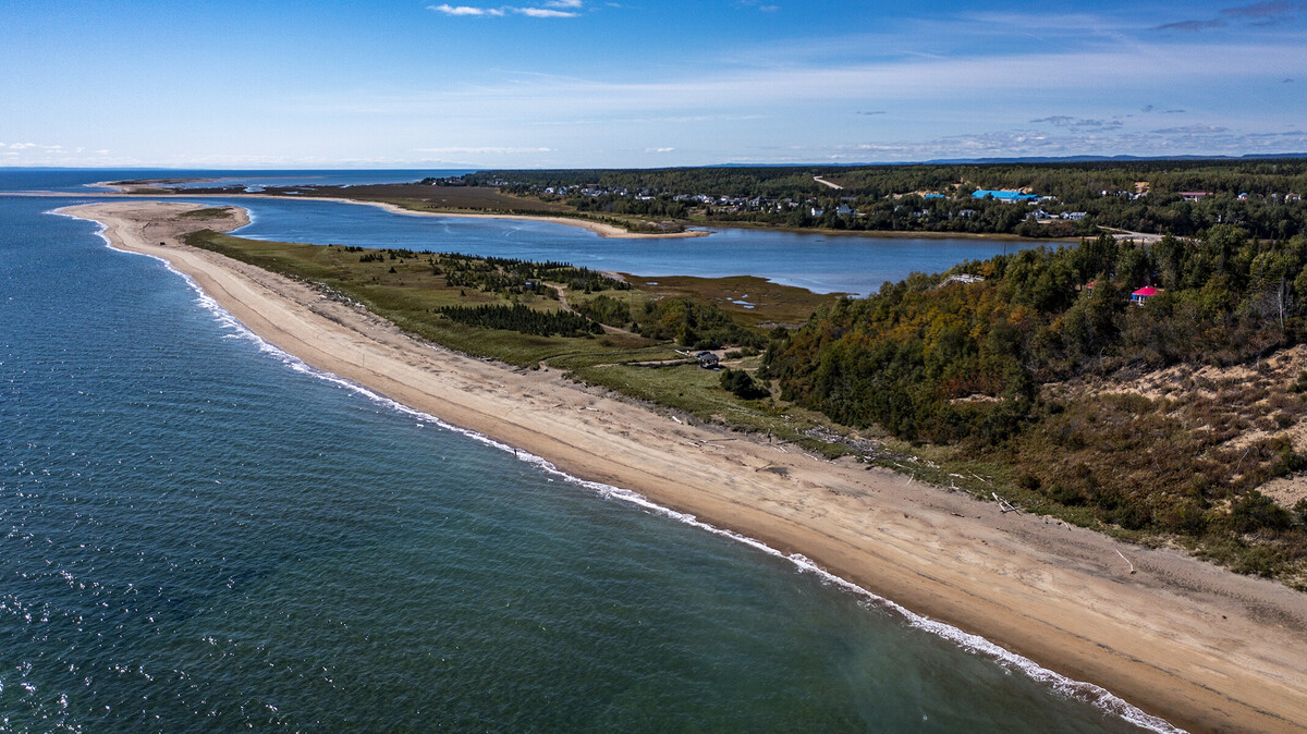
Landscape #3
Observatory at Pointe-des-Fortin
During your stop in Portneuf-sur-Mer, take a stroll along the vast sandbanks that stretch on either side of the Portneuf River. To the east of the river, Pointe-des-Fortin offers a small lookout point and the opportunity to extend your walk on the sand for about 1.5 kilometers. This sandbank is ideal for long walks and birdwatching. In fact, the tip of Grand Banc is recognized by the World Wide Fund for Nature and BirdLife International as an Important Bird Area (IBA).
·
·
♦
·
·
·
·
·
·
·
·
·
·
128 KM
·
·
·
·
·
·
·
·
·
·
·
·
·
·
·
·
♦
·
·
·
·
·
·
·
·
·
·
·
·
575 KM
·
·

Landscape #4
St-Pancrace Lookout
The St-Pancrace lookout, located 8 kilometers east of Baie-Comeau, offers a magnificent view at an altitude of 600 meters (approximately 2000 feet for the more traditional). Access is via a parking lot on Route 138 (on the right when coming from Baie-Comeau).
From here, you can admire the most beautiful view of the fjard and St-Pancrace Cove, as well as the St. Lawrence River stretching endlessly before our dazzled eyes. A testament to the passage of glaciers, this grandiose landscape reminds us of our humble place on our vast planet... If there is ONE place where you MUST take a selfie, it's here!

·
·
·
·
·
·
·
·
·
·
·
·
·
·
·
·
·
·
·
·
·
·
·
·
·
·
•
168 KM
Landscape #5
Mont Daviault
Mont Daviault is the hill located opposite the mining town of Fermont. Directly across Lake Daviault, a 30-minute walk from the famous wall, this small mountain is a family-friendly destination accessible to all. To reach the sky-blue cross that stands at the summit, you have the choice of 4 trails. They all start from the small bridge located at the entrance of the site.
♦
·
·
·
·
·
·
·
·
·
655 KM
·
·
·
·
·
·
·
·
·
·
·
·
·
·
·
·
·
·
·
·
·
·
·

Landscape #6
Pointe-des-Monts Lighthouse
Erected in 1830, this lighthouse was classified as a historical monument by the Quebec government in 1964. Today, it serves as a true heritage museum, with seven floors illustrating various themes, including the lives of the eight keepers who worked there, navigation, and shipwrecks near Pointe-des-Monts. The lookout balcony, the highest point of this 30-meter lighthouse, offers a 360-degree view of the river and its surroundings, allowing for whale watching as they come to feed near the shore. This microregion is a place of natural rejuvenation.
♦
·
·
·
·
·
·
·
·
·
·
97 KM
·
·
·
·
·
·
·
·
·
·
·
·
·
·
·
•
168 KM

·
·
·
·
·
·
·
·
♦
·
·
·
·
·
·
•
Landscape #7
Lac Walker - Port-Cartier-Sept-Îles Wildlife Reserve
Lake Walker is located within the Port-Cartier-Sept-Îles Wildlife Reserve, situated approximately 30 kilometers west of the town of Port-Cartier. With a depth of 280 meters, it is the deepest lake in Quebec. Its spectacular panoramas make it a remarkable place with strong recreational tourism potential that deserves to be further promoted and protected.
·
·
·
·
·
50,5 KM
·
·
·
·
·
·
·
·
·
·
·
·
·
·
♦
·
·
·
·
·
·
·
·
·
97 KM
·


·
·
·
·
·
·
·
·
·
·
·
·
·
·
♦
·
·
·
·
·
·
·
·
·
·
333 KM
·
·
·
·
·
·
·
·
·
·
·
·
·
·
♦
Landscape #9
Manitou Falls
About 85 km east of Sept-Îles and 35 km from Rivière-au-Tonnerre, a stop is a must: a 35-meter-high waterfall awaits you at the end of a trail. A tourist information center with ample parking and picnic tables makes your stop enjoyable.
Average duration: 45 minutes

Landscape #10
Brion Trail
Head to the end of Route 138 in Kegaska. From this charming village, you can admire the view of the estuary as well as the wreck of the Brion. A beautiful spot to watch the sunset!