RBMU and its partners invite you to explore the many highlights and attractions of this unique territory!
A biosphere region is a territory recognized by UNESCO where people and nature are encouraged to coexist in harmony. There are 20 biosphere regions in Canada and nearly 800 around the world.
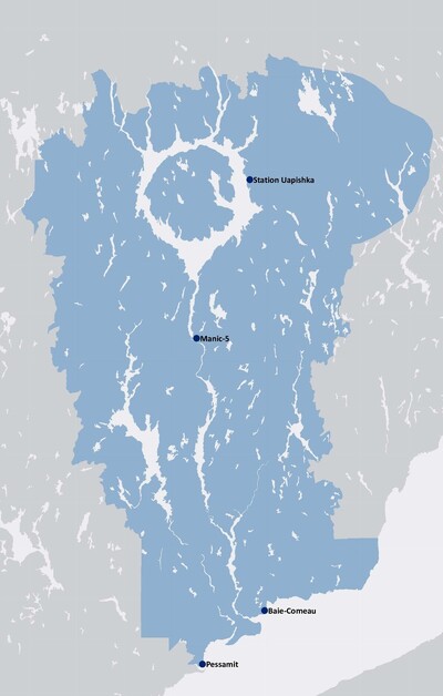
The Manicouagan-Uapishka Biosphere Region (MUBR) stretches from Pessamit to Baie-Trinité and extends into the Uapishka (Groulx) Mountains, covering an area of nearly 55,000 km².
It stands out for its unique features: a meteorite impact crater visible from space, landscapes where Arctic tundra meets boreal forest, exceptionally rare geological sites, and ecologically rich terrestrial and marine protected areas. The region lies at the heart of the Nitassinan of the Pessamit Innu, an ancestral territory whose culture and traditional knowledge form a living and essential heritage.
Its history has also been shaped by the development of natural resources. Hydroelectricity, forestry, and aluminum production have influenced the land and its communities over time. Today, these activities coexist with conservation efforts, economic revitalization, and reconciliation initiatives, defining some of the region's key challenges and aspirations for the future.
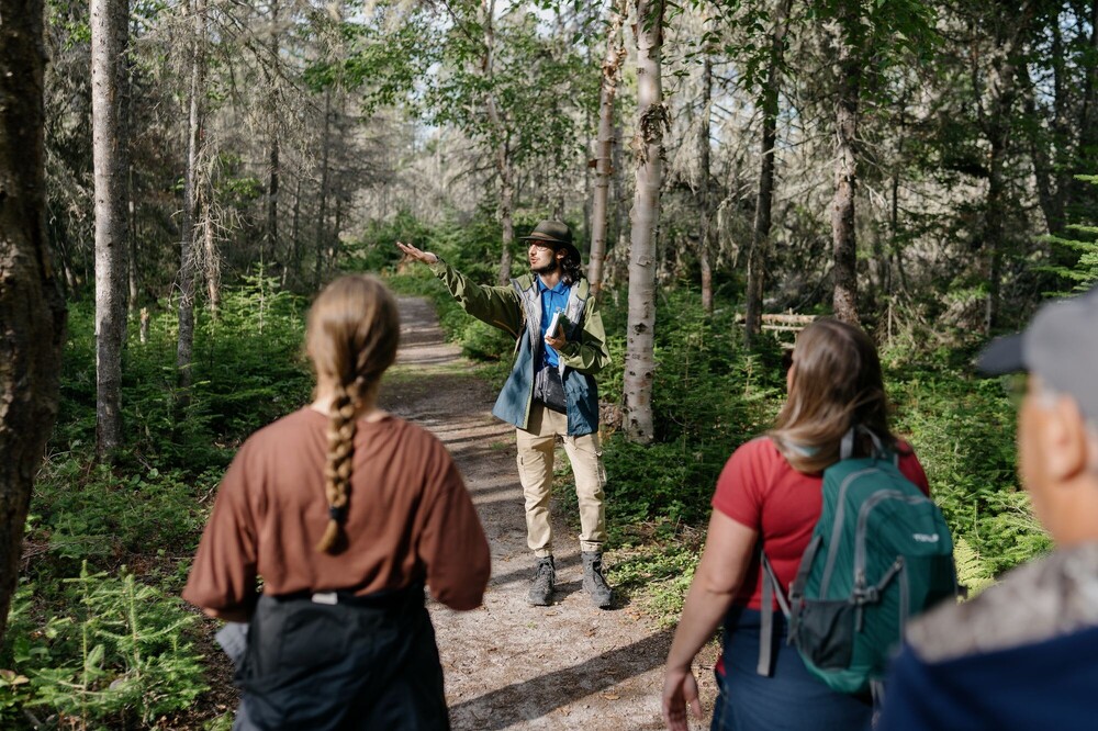
Pessamit: Guided Tour of the Traditional Site (Shaputuan)
Immerse yourself in the history and traditions of the Innu community of Pessamit with an experienced guide for an in-depth exploration of the traditional site. You can also participate in a craft workshop and enjoy a storytelling session featuring legends, along with a tasting of bannock and Labrador tea.
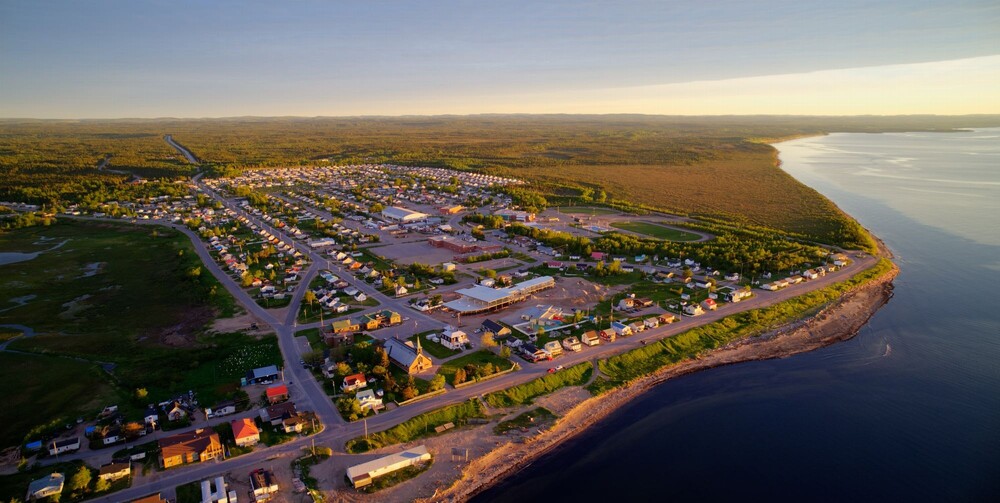
Pessamit
Pessamit Tourism Information Kiosk, 32 Utipan Street

Self-guided tour of the exhibition Sous les barrages:
Tshishe Manikuan and the Papinachois site
Discover the immersive trail “Sous les Barrages,” located along Laletaut Street. Exploring the interpretive panels can be combined with a captivating audio experience that immerses you in the nomadic history of the Innu.
This podcast series is a sensitive and powerful production, recorded right here in Manicouagan, that gives a voice to the elders of the Pessamit community and explores the impacts of large hydroelectric projects on their way of life, their environment, and their future.
Pessamit - Departure from the Cultural Center
Tip: Download the 7 podcast episodes and listen to them during your road trip on Route 389!
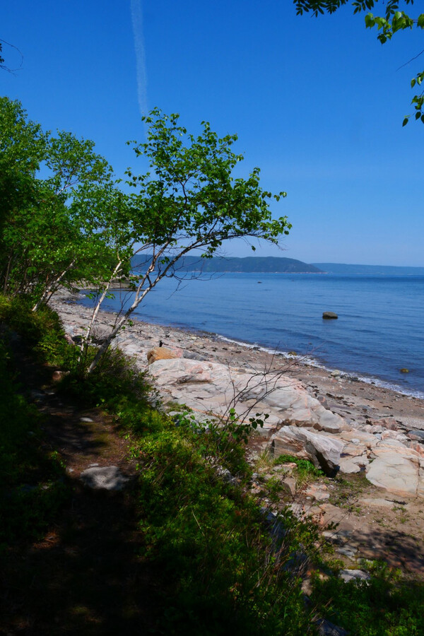
A Walk Along the Sentier de la Fascine Trail
This 800-meter trail offers wonderful views of the St. Lawrence River. Along the way, there are 10 interpretive panels about the archipelago's natural environment and history. It is one of the designated observation sites along the Whale Route for spotting birds and marine mammals (harbor seals) from land. Near the dock, on the rocks, you can see geological traces—grooves—that bear witness to the movement of glaciers thousands of years ago.
Ragueneau
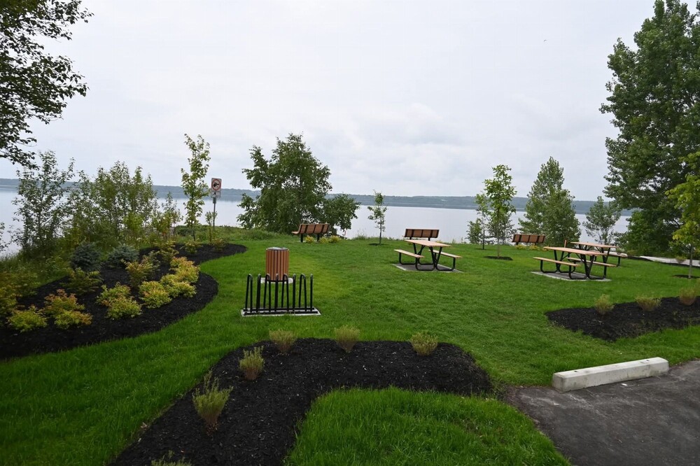
Exploring the Pointe-aux-Outardes
Nature Park
A well-deserved break awaits at Pointes-aux-Outardes Nature Park, where visitors can stroll through nine distinct ecosystems, sleep in a giant birdhouse, and explore the new visitor and interpretation center, which features an immersive exhibition designed to showcase the richness of the Manicouagan Marine Protected Area.
Originally proposed as part of the municipal “Ma Ville Ma Voix” initiative, the construction of this pavilion is the result of a broad citizen engagement effort.
Pointe-aux-Outardes
4 Rue Labrie, QC G0H 1M0

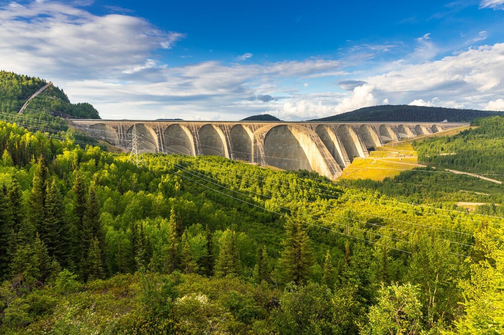
Tour of the Manic 5 Dam
The Daniel-Johnson Dam (Manic 5) holds the title of the world's largest buttressed, multi-arch dam. Its presence dominates the landscape and stands as a testament to Quebec's ingenuity. The dams built throughout the river network of the biosphere region, which has significant hydropower potential, account for nearly a quarter of the province's hydroelectric production. Short on time or looking to reduce your carbon footprint? You can also tour the Jean-Lesage Power Plant (Manic 2)!
Route 389, KM 214
Astuce : Pensez à réserver votre visite en avance !
Discovering the Heart of Quebec
The Manicouagan Reservoir
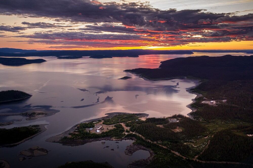
Our region bears a mark that's visible… even from space! It's the fourth-largest meteorite impact crater in the world, known as the “Eye of Quebec.” Today, this crater has become Manicouagan Reservoir, a vast ring of water.
In fact, at 455 meters deep, it is the deepest lake in Quebec! Lake Manicouagan lies 320 meters below the surface of the reservoir of the same name, created in the 1960s by the construction of the Daniel-Johnson Dam, which powers the Manic-5 hydroelectric plant. A second lake, Mouchalagan, lies 130 meters below the surface.
Road 389, KM 336
Tip: Explore the reservoir in your own boat from Uapishka Station! It takes about 7 to 9 days of kayaking to go all the way around it!
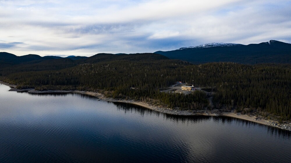
Stop at Uapishka Station
and a walk along its interpretive trail
A must-see stop to add to your road trip! Located at the foot of the Uapishka (Groulx) Mountains and on the shores of Manicouagan Crater Lake, Station Uapishka offers dining options and accommodations in a lodge or cottage. This northern ecolodge also serves as a base camp for scientific research teams and will take you on a journey to discover Innu culture in the heart of the Nitassinan of the Pessamit Innu.
Hike a 5-km trail lined with bilingual interpretive signs (French and Innu-Aimun) leading to a lookout point designed in collaboration with the Pessamit community. This project highlights the territories submerged by the waters of the Manicouagan Reservoir, promotes Indigenous and scientific knowledge, fosters an understanding of northern ecosystems, and raises public awareness of the fragility of the territory in the face of rapid change.
Road 389, KM 336
Did you know that the word “Uapishka” means “rocky peaks that are always covered in snow” in Innu-Aimun?
Hike in the Uapishka Mountains (Groulx)
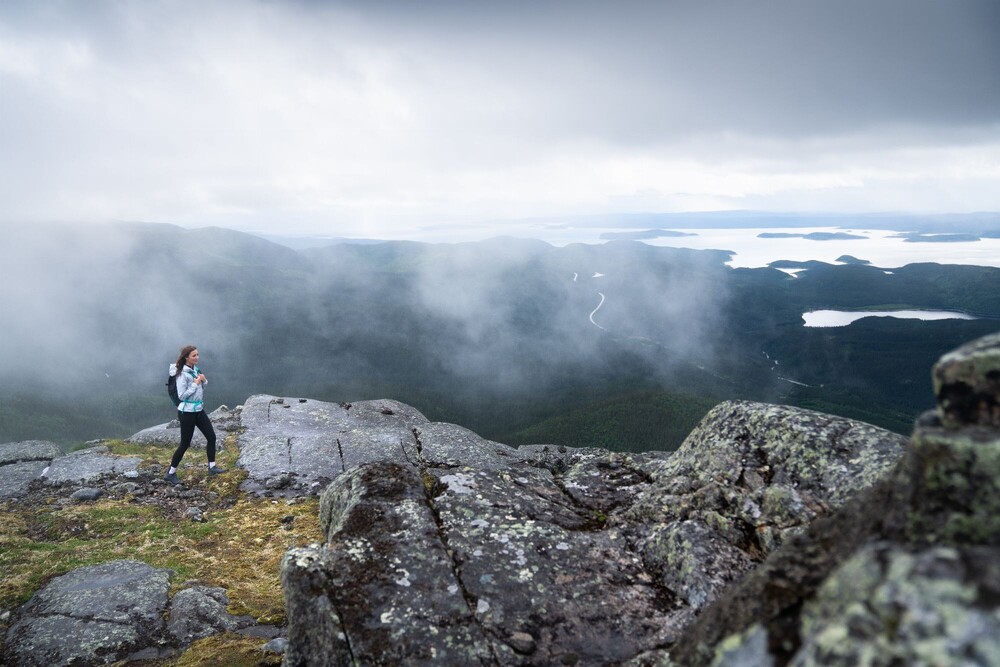
If you love northern panoramas, the Uapishka Mountains offer incredible hikes, such as the one up Mount Harfang. An approximately 11-km loop will take you to the summit, where the magnificent view of the eastern part of Manicouagan Crater Lake and René-Levasseur Island is sure to take your breath away! The Uapishka Mountains form the northern heart of the territory, with peaks over 1,000 meters high, where you'll find both fir and white birch forests and Arctic tundra.
Get involved in science by downloading iNaturalist on your phone and help our teams collect valuable data on the flora of the Uapishka Mountains.
Road 389, KM 349 ou KM 352

Stop at the Old Post Office site
Located at the confluence of the Amédée and Manicouagan rivers, Parc du Vieux Poste was formerly known as the village of St-Eugène de Manicouagan. It's a beautiful spot to admire waterfalls and enjoy a picnic. The revitalization of the Vieux Poste site is one of the projects developed through the “Ma Ville Ma Voix” citizen participation initiative.
Baie-Comeau, secteur Mingan
Walk through the Boisé de la Pointe St-Gilles
Your walk will take you along a section of the Sentier des Embruns, a trail that stretches for about 21 km and runs alongside the St. Lawrence River and its beaches. The Sentier des Embruns is the result of a collective effort based on a citizen-proposed idea submitted as part of the “Ma Ville Ma Voix” citizen participation initiative, launched by the City of Baie-Comeau, supported by MU Conseils, and funded by the Baie-Comeau Aluminum Plant Fund for Sustainable Communities.
Baie-Comeau, secteur Marquette
Champlain Beach Access
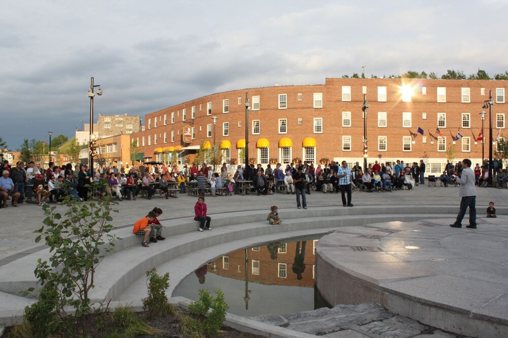
A break at Place de la Biosphère
Combining urban planning and creativity, this redevelopment project earned the municipality of Baie-Comeau a Prix Aménagement award. The space features, among other things, a fountain on Place Lasalle that commemorates the region's official inclusion in the international network of UNESCO Biosphere Reserves on September 18, 2007. It's a lovely place to grab a bite to eat and meet local business owners.
Baie-Comeau
Downtown, secteur Marquette
Relive the history
of Baie-Comeau's founding
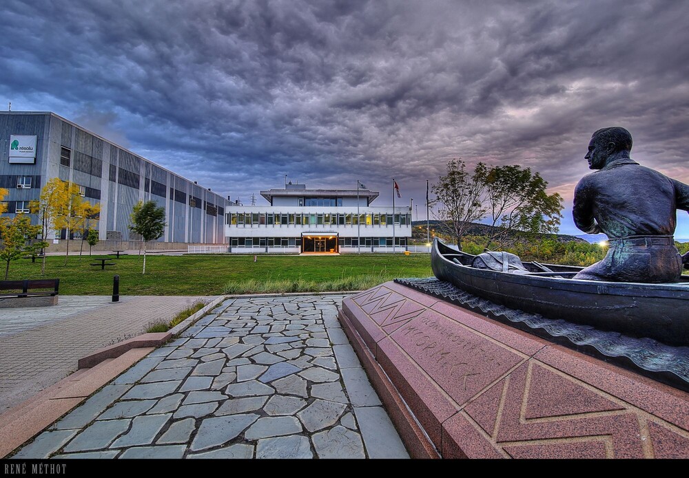
Relive the history of Baie-Comeau with a local guide. Discover the life of Colonel Robert R. McCormick, who founded the town around his paper mill, and visit Place La Salle and its historic monuments, as well as the impressive Sainte-Amélie Church with its frescoes worthy of the Sistine Chapel!
Baie-Comeau, Downtown, Marquette neighborhood
Tip: You can rent an audio guide at the tourist information office.
Exploring the parc des Pionniers
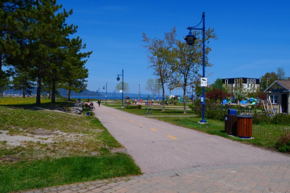
Pioneers Park connects the historic district to the marina and offers beautiful views of the river. If you happen to visit on a day when the farmers' market is open, take the opportunity to meet our local producers, processors, artisans, young entrepreneurs, and organizations. From there, you can walk to the Port of Baie-Comeau, which is the sixth-largest port in Quebec and also the fifth-most-visited port of call for international cruise lines on the St. Lawrence River.
Baie-Comeau
Downtown, secteur Marquette
Stop at the fjard of Saint-Pancrace
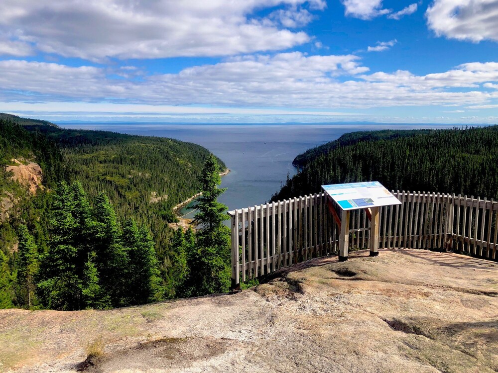
A magnificent viewpoint nestled at an altitude of 600 m, featuring a lookout platform that offers a better view of this cousin of the fjord—the fjard, which is shallower and has gentler terrain.
Pssst, hidden in the depths of the fjard is the Greenland shark, a species known to live up to 400 years!
Baie-Comeau
Road 138, 8 km au Nord
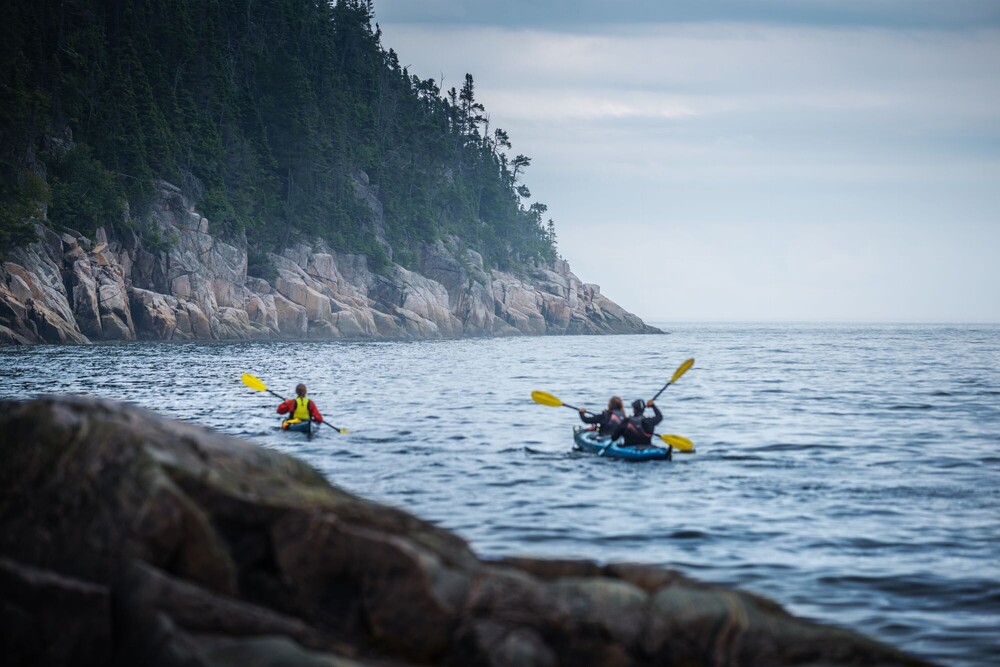
Exploring the geological site
of the Baie-Comeau grooves as seen from the water
One of the most beautiful panoramic views of Manicouagan unfolds before you as you paddle in a kayak with your guide. It's the perfect opportunity to observe the impressive glacial grooves that were carved out thousands of years ago. With a little luck, you might even spot marine mammals and waterbirds unique to our northern coastal wildlife!
Franquelin
56 Rte Jacques Cartier #12
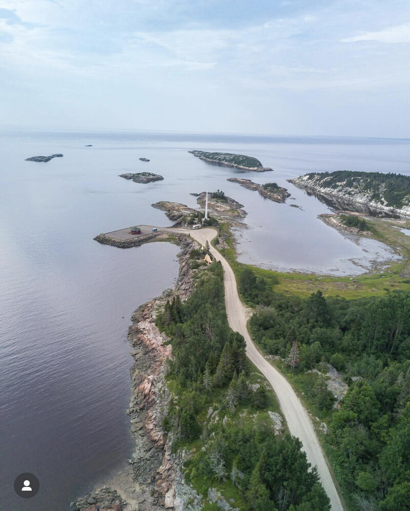
Tour of the Pointe-des-Monts Lighthouse Geological Site
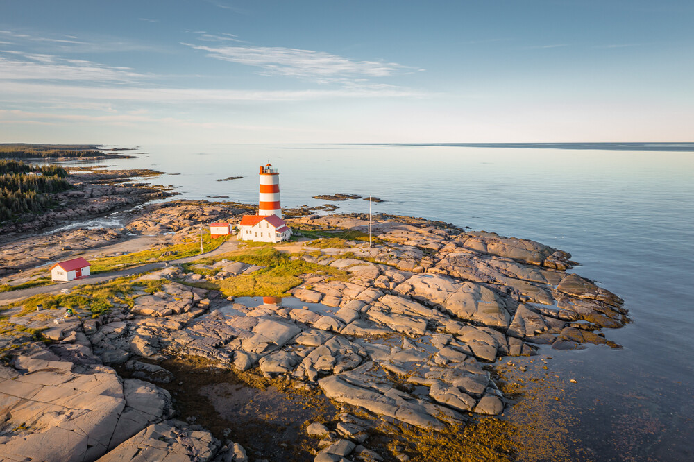
This exceptional geological site is located on Vieux Phare Island. It features an outcrop cut through by dykes, that is bands of magmatic rock ranging in thickness from a few tens to a few hundreds of meters. You can also visit the Pointe-des-Monts Lighthouse, climb the seven floors of the exhibition, and enjoy the 360-degree panoramic view from a height of 21 meters (69 feet) above the ground.
Pointe-des-monts
1830, chemin du Vieux Phare